Time for the guys to go to the mountains again. It's been a couple of years and it seemed that Josh got over what happened last time. This time I was determined to show him some granite and see if he could dig it as much as me. I didn't want to necessarily throw some really high stuff at him since I was unsure of how he would handle the altitude, so I went with a place that had most of the grandeur, but stuck mostly between 7000 and 10000 ft. Desolation Wilderness fit the bill. I was fortunate enough to secure some overnight permits mostly because I had picked a rugged, far from the trailhead "zone" for our first nights destination. It seems that this limits the amount of backpackers applying for this particular permit. I had designed a lollipop loop that started from Wrights lake, climbing six miles over Rockbound Pass, then continuing on Rockbound, but then veering off to travel the McConnel Lake loop where we intended to stay the first night. After the loop I wanted to climb up to the Velma Lakes and then up over Dicks Pass, then descending to lake Aloha for night two. Third day we would climb up over Mosquito Pass, then descend along with the Rubicon River, taking our first chance we could get to climb back up to Rockbound Pass and descend the final six miles back to the car. I think the whole trip would be about 42 miles with 8000 ft of climbing, and I felt pretty confident that Josh could do it. I intended to stay flexible with agenda though, knowing that all kinds of things can derail these type of plans.
We started at Wrights lake in bottom left and traveled on Rockbound (north) until we veered off on the McConnell Lakes loop(purple and turquoise). Day two we finished off the loop and went up to Velma Lake and Dicks Pass, then to Lake Aloha(orange). Day 3 we went over Mosquito Pass and followed the Rubicon down until we went back to Rockbound and the car(purple). Sorry, don't have turn by turn, but if you have a map you can trace where we went.
The day started with a 5 a.m. wake-up, and a couple of hour drive to get past Sacramento before the traffic really starts. Got a solid breakfast and then an hour later arrived at the trail-head. The weather was looking perfect for the trip, low 70s for the high, and in the 40s at night.
Beauty Lake was Josh's introduction to the Alpine lake smorgasbord.
Rockbound - living up to the name. Josh really enjoyed the rocky trails (in the beginning).
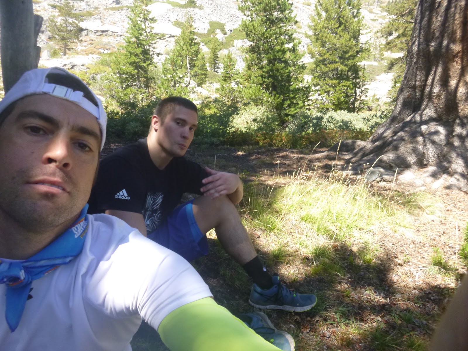
Location of our first snack break.
Still in good spirits.
Rockbound Pass (8500 ft), looking back at where we came.
Video from Pass:
Lunch at lake on other side of pass.
Looking down at lake Schmidel as we climb over the next pass beginning the McConnel Lakes loop. At the top of this pass we hit our first low-point of the trip when Josh started to wonder whether he could keep going or not. His blisters were giving him issues and he was sucking air and thinking that the altitude was taking it out of him. We took a nice long break at the top - I helped him get a better tape job on his blisters, got some food in him, and as we descended he seemed to bounce back a bit. I think he took some confidence from this experience that things don't always keep getting worse and you can bounce back.
Video of Josh not falling down the mountain:
One of the high alpine meadows in the loop.
Dinner time. Josh was super proud of finding his rock "recliner"
Sun going down.
The trail started getting a little sketchy after hikers were warned that travel past this point would be hazardous to stock animals. We navigated down a rock hillside with nothing but a series of Cairns guiding our way. As we were loosing light, Josh spotted a great spot to set up for the night and we bivied up.
Video of where we are going to die:
Hilarious shot I got of the human tomato the next morning.
Super happy.
Time to get going again!
First of the "Q" lakes.
I think the sign on the other side said "hazardous", this one's warning was even more ominous.
Interesting shape for a tree on the climb up to Velma Lakes.
Finally got a view of lake Tahoe up at Dardenelles.
Looking down at Dicks lake and Dardenelles as we climb up to the 9400 ft Dick's Pass.
Video at Dick's Pass:
Looking down the other side of Dicks.
Dinner time. It was after we packed up from this to do our last couple of miles of the day that Josh's ankle really started giving him some trouble. I was getting worried and started going through potential bailout plans. I even ran a couple of scenarios past him, but he seemed intent to finish the thing. At some point it seemed he was able to get the ankle to loosen up enough that we were moving ok again and I thought we might be alright. Still, that night I sent a message via Delorme to Joanne about his ankle. I think we received plenty of prayer, and he got a great nights sleep, and the ankle performed admirably on the last day.
Josh - hobbling along with his walking stick.
Josh picked another winner of a camping spot at lake Aloha. It was an incredibly windy night though.
Video of Aloha campsite:
Packing up the next morning.
Aloha!
Descending from Mosquito Pass.
Video of Josh braving the "dam":
Up and over Rockbound one last time and back to the car.
Josh did seem to be proud and happy to complete the loop that I designed. His feet did take a lot of blister damage and he was worn to the bone when we finished, but he says he had fun. He admitted that it was not necessarily his kind of fun. It might take another couple of years before he decides to submit himself to this kind of adventure again, but for some reason he decided to come back after last time, and hopefully his body and mind can bounce back from this and he can enjoy the memories from this trip. I know that I will cherish these memories! On the way home we were able to stop in Placerville and have an awesome post trip dinner (they are always the best when you are famished and tired of trail food). Fried mushrooms, schnitzel and German lager. Great stuff.
The Desolation Wilderness is a awesome place. I’ve been backpacking there almost every year now for decades out of the Meeks Bay trailhead. I first noticed your post on backpacking post in Coe on your Strava. So, I dug a bit further and found the blog. Just very cool Jeremy.
Glad you got to check out the blog! That trail out of Meeks Bay is one of my favorites... I think it is called the little Yosemite maybe? Anyways, I think we are blessed with all the awesome backpacking country around here...


That sleeping bag pic though--every time I see it, I laugh with my belly--it gets to me!
ReplyDeleteGlad you guys had fun and survived! :) Good write up.
Thanks for the write up Jeremy. Any way to show a map with the route? Sounds like a great trip in the Wilderness. Congrats on the brotherly bonding.
ReplyDeleteGreat point Jon! Sachin just showed me how to stitch the gps data together, so I will try and get some better stuff up on here. Stay tuned!
DeleteThe Desolation Wilderness is a awesome place. I’ve been backpacking there almost every year now for decades out of the Meeks Bay trailhead. I first noticed your post on backpacking post in Coe on your Strava. So, I dug a bit further and found the blog. Just very cool Jeremy.
ReplyDeleteGlad you got to check out the blog! That trail out of Meeks Bay is one of my favorites... I think it is called the little Yosemite maybe? Anyways, I think we are blessed with all the awesome backpacking country around here...
Delete