"
I only wish you might have beheld the scene. Five large oaks, their branches festooned with lichens, are our canopy. The bright fire lights up their trunks and foliage and the group around. The moonlight lies soft on the plain and lights up the black mass of the peak, Ojo de Agua de la Coche, that rises back of the camp, its black outlines sharp against the blue sky."
-Henry Brewer
Back to Henry Coe State Park! Yes! This time I brought my own personal photographer. All pictures were taken by Toshi Hosaka, thanks to his marginally operating camera, which was 100% more effective than my minimally operating camera...
There was finally some rain here in California a couple of weeks ago, so it seemed like if there was a time to hit up Henry Coe it would be in this window. This park is notorious for scarcity of water, and it is prudent to cover ground when you know you can get to it. I had a difficult trip here last year by myself, but this year Toshi was excited to join me and it was a pleasure to show him some of this rugged wilderness.
We started from the headquarters and headed down to China Hole with plans of doing a counter-clockwise navigation of the park, hitting up several peaks and waterfalls along the way.
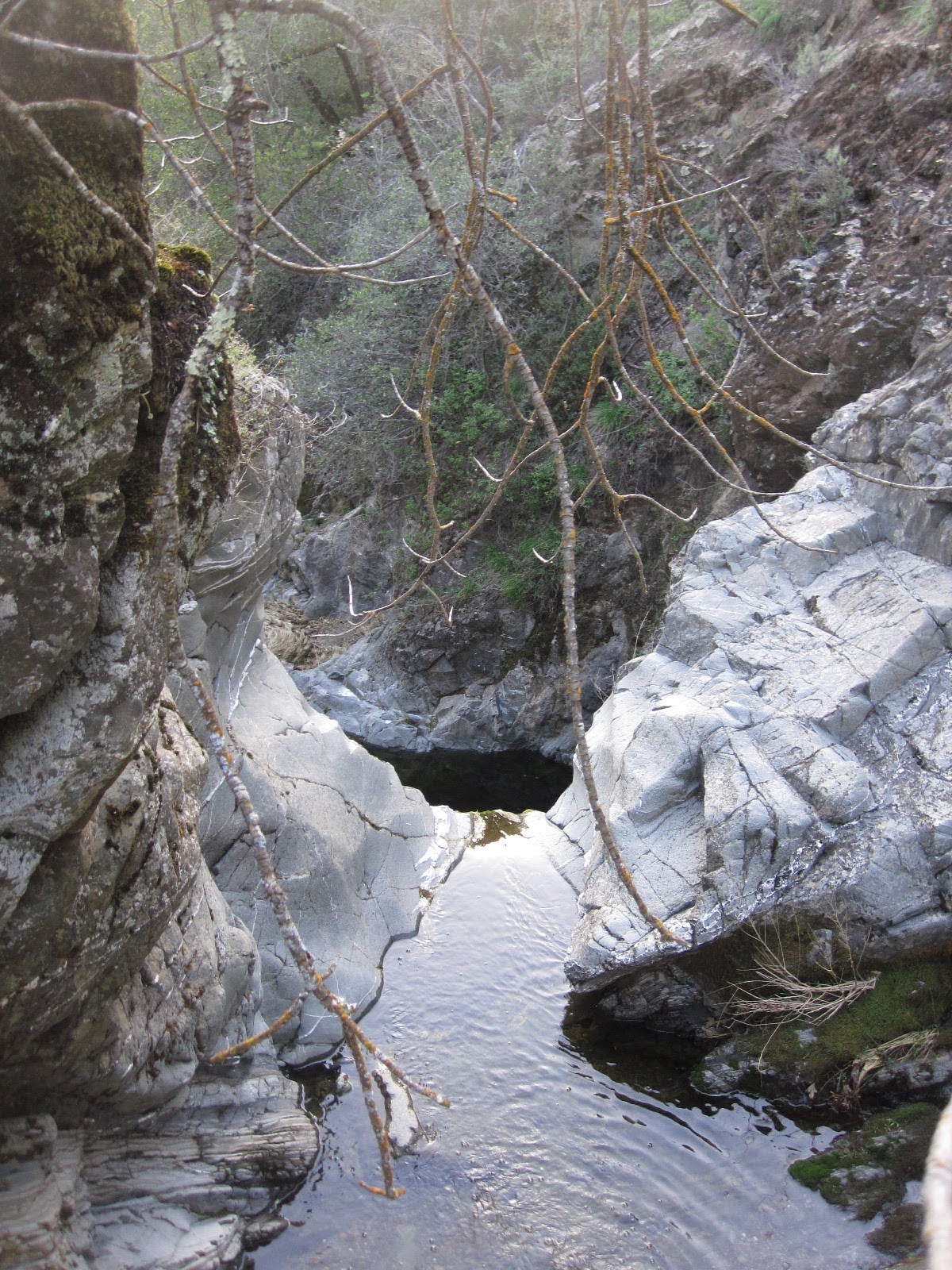
 |
| On the way down to China Hole. |
 |
| Joanne likes this pic. |
 |
| China Hole. |
 |
| Can you spot the trail? |
 |
| My favorite pic. |
 |
| This is classic Coe. |
 |
| Dinner time. |
 |
| Time to bag our last peak for the day. |
A goal for me for day one was to try and find a waterfall down in grizzly gulch. We made our way down to the south end of the park and found an intersection with the gulch. We then followed the stream up, hopping rocks, wading, skirting along on the hillsides until we found our first waterfall. Then Toshi suggested we could climb the waterfall and keep going, but on further inspection we decided to climb around the side of the waterfall and we kept following the stream. It was an pretty, secluded place. We kept finding small falls, and then found another big one. Once again we resolved to try to climb around it, but this time the crumbly rocks jostled our confidence a little and we decided to bail and bushwhack up the hill to try to connect with the trail. On the way up to the trail we came across an old shack/ranch house/whatever, but it was in the middle of the woods and it was old. We checked it out. Plenty of old artifacts and an eerie, lonely feeling. It is fun to find random stuff like that.
We made it back up to the trail and made our way towards the ultimate destination for the day: Wilson Peak. The sun was just going down and we decided to sit down and have dinner and then do a night hike up the peak and camp at the top. I warned Toshi about the exposed ridges at night, how the wind can be pretty miserable, but I had a tent to test out and Toshi was really set on the idea, so Wilson Peak it was.
It was a full moon, so we didn't even need our headlamps. A peaceful, beautiful night. We located the peak and set up camp only to spot a line of lights smoothly cruising some trails in the distance. They kept getting closer and eventually made it up to our peak and then kept going. Just some mountain bikers out for a night ride. People know how to have fun! It turns out there was some pretty good wind during the middle of the night, but Toshi said it actually worked pretty good to keep condensation down in the bivy setup.
 |
| I think Toshi likes this place. |
 |
| Random rock. |
The next morning we made our way over to Kelly Peak, where Toshi actually found a summit register, which he was totally stoked about. I was out of water by this point so we took it easy going towards Pacheco Falls, our next destination. We passed "Live Oak Spring" along the way, but it just turned out to be a trough filled with water and green stuff... no flow. So we just decided to make it down to the falls and get our water there. Pacheco Falls was another beautiful waterfall. We filled up there, had some breakfast, Toshi got his coffee, and then we had an argument about whether we should take the steep road back to the trail to put us on track for Mustang Peak, or try a shortcut and climb the ridge. I saw way too much poison oak and bailed, turns out it probably would not have mattered anyway as I ended up with PO all over after this trip!
The hike to Mustang Peak was a long, exposed fireroad. The views were quite spectacular, but the sun was making us pay. The Peak is worth it though. It isn't nearly the tallest point in the park, but the view-shed is terrific.
 |
| Strange creatures lurking. |
After Mustang Peak, we followed some more exposed fireroad down to Orestimba creek with our next destination being Rooster Comb. The Rooster Comb is a really neat rock formation. Toshi and I climbed to the top, took in some awesome views of the valley and had some fun scrambling along the ridge. Toshi tried to find the most vertical section of rock to test out his climbing skills. I spotted him from the bottom and it was pretty cool to watch him scale those rocks!
 |
| Playing on the Rooster Comb! |
 |
| Can you spot the Toshi? |
 |
| Can you see him now? |
 |
| From top of Rooster. |
 |
| More from Rooster. |
 |
| Another interesting rock formation near the comb. |
 |
| There are plenty of these at Coe! |
 |
| Getting ready to climb Stakes! |
After rooster we kept heading north along the creek expecting to fill up on water at the confluence of Robison Creek and Orestimba just as the sun was going down. There we had our dinner and prepared for another night hike. This time we were going to be climbing from one of the low points in the park at 950 ft to the highest point at Mount Stakes at about 3800 ft. It was another incredibly bright moon lighting the way for us, and this trail picked up elevation FAST. It was definitely one of the longest, steepest, most sustained climbs that I have ever done. And I was glad that we did it with the sun gone. This is another hike that is exposed and the sun will get you fast, especially considering there really is no water around once you leave the creek. Last year I tried to take something called the Pinto Creek trail to get up there. But that was a mistake. I ended up bushwhacking to the top and taking up most of my day doing it, all the while getting pretty dehydrated. The trail we took this year was 100x better. We got to the top of the ridge (not quite the summit yet) by about 9:30 I think and set up camp. I was having some terrible issues with my nose bleeding on the way up and would end up making a mess of things that night, but it got better the next morning. That night was a peaceful night with hardly any wind.
 |
| Next morning on the ridge. |

The next morning we followed the dirt road on top of the ridge to Mt. Stakes. We then had a debate about how to get down the mountain, eventually deciding on following a dirt road that we could see plainly following the ridge down towards the red creek valley, It was the road that matched up pretty good with a map that Toshi had (we were no longer in Henry Coe, so that map wasn't really that useful). We followed it down, but then reached a four way intersection. Toshi decided we should go straight, but then after following it down for half a mile it pretty much fizzled out into the manzanita brush. We decided that it was too much work to go back to the intersection where the next pick might just dead end us as well, so we bushwhacked from this point. This was really unpleasant for me in my shorts, but I did it before and knew it would heal up just fine. The legs did look pretty gnarly afterwards though, and I did step on something sharp that went all the way through my shoe and punctured my foot. Oh well.
 |
| Stakes! |
We knew we were technically not in the park anymore and roaming around on someone's property, but there was not sign of humans anywhere. It is pretty desolate out there! We made our way down to red creek road and then followed that back into the park and all the way to the chaparral trail. Last year I had asked the rangers whether I could go through this little section of the map that said it was private property (completely enclosed by the park), because that was what I deemed necessary to get to the Orestimba Wilderness in the most efficient manner. They shut me down of course, but this time as we headed up the chaparral trail I knew we were going to be intersecting with this "private property" to try and make it back to the car by nightfall. We got to the top of the ridge and there was county line road. No indications that it was private anything, just looked like another trail. In fact, there was nothing up there, except a dirt road that led to bear mountain (which is in the park). It was baffling my how anyone would this land would be useful for any private concerns. Well, now I know, don't worry about that stretch, it's all good. We bagged bear mountain and then made our way down to the east fork of the coyote river. I was pretty hot at this point and delighted in a five minute soak in the stream.
 |
| Red Creek road, way above red creek. |
 |
| Best lizard ever. |
 |
| There's Red Creek. |
Toshi and I followed the "Narrows" back to China Hole and made our way back up to the car right as the sun was going down. Perfect timing.
Post trip it turns out the Poison Oak, that I probably got on the first day scrambling around the waterfalls and such was really bad. As in it is probably the worst I have ever had it. But I am surviving. Going to Henry Coe does not assure you poison oak reaction, I was just stupid. You can avoid those off trail sections, or you could wear more cloths and be really careful with the cloths once you take them off. I have not yet learned. I am not totally sure why I come back to this park. It has to be the combination of it's sheer size and ruggedness, along with it's proximity to where I live. There really is a lot to explore and it is not easy hiking. Your skills definitely get tested. It is also amazing to me how few people actually get back into the park. Toshi and I saw no one on Sunday until we were within 5 miles of headquarters. The park just seems very underutilized. But that makes it like a cool secret and secluded getaway.
The waterfall pics:
Camping Setup:
 |
| Toshi |
 |
| Jeremy |
This was my first fastpacking trip trying out a tent. This is the mountain hardware supermega ultra light 2, which is a mouthful, but basically means it is a really light, and really expensive two person tent. I got a good deal on it thanks to Judy Hosaka (who had access to a factory outlet). It is pretty much what I would consider a standard for this class- aluminum poles, double wall, about 2.5 pounds.
Plusses:
- Clear boundary between your realm and natures realm. This is really nice. The different rustling sounds you hear, the bugs buzzing, etc. Doesn't matter as much when you know there is a barrier.
- Don't worry about bugs.
- Shields from wind and rain.
- Nice enclosed, clean space to put your stuff. I could lay out my stuff sacks, map, etc, and just fall asleep and not worry about putting it all away somewhere.
- Good ventilation keeps stuff dry. Less need for a "dry out" break during a sunny day.
Minuses:
- Clear boundary between your realm and natures realm. I really enjoy being out in the open. I really enjoy falling asleep under the stars. Being a little exposed is kinda nice sometimes. It is just a different experience with a tent.
- One to two pounds heavier base weight.
- Takes up a ton of volume in your pack. I barely fit everything in. There is no way I could fit it in with a bear canister, which would be tough for the Sierra.
- A little more setup and tear down time.
- Wind causes a lot of noise.
Overall, I think it has a place in my fastpacking gear lineup. It just depends on what conditions I think I might face and what kind of experience I am looking for. And it will be great if I get to take the wife or a kid out on an adventure...
Other Gear Notes:
- The pack sustained some more damage on this trip. The bushwhacking really takes it's toll on the mesh pocket, but a little sowing job ought to fix it. The Gossamer Gear Gorilla is still kicking!
- I had to buy new black diamond ultra distance z-poles. They were fantastic of course, I just hope they last longer this time...
- Everything I usually bring worked like clockwork. The jetboil is about as efficient as they come. I was hoping to finish off the remnants of the last two canisters of fuel that I had, and cooking for Toshi and me, we only finished off one of them.
- Food: A couple of backpacking indian dinners, Jerky, some vacuum packed salmon, assorted dried fruits, "Joanne Bars", chocolate. That was about it. I think I have my backpacking food dialed in now.
- Bandana for neck. Worked great. My neck suffered after last years trip, but it was fine this time, and if you wet it down whenever you get the chance, it really does help keep you cool.
- Toshi borrowed Marc's SPOT for this trip. It was a handy thing to have around, just in case of emergency, but the best part about it was when we got back and could see our tracks through the park. Definitely a cool gizmo.


Good post! Loved all the pictures, thanks Toshi! Bummer that your camera is on the fritz, Jeremy. And that you have PO ALL OVER YOUR BODY. Glad you still had fun though and that it was worth it.
ReplyDeleteUm, sorry about the PO... I will bring a PO soap that's supposed to work very well.
DeleteLOVED the report! You've captured the essence of the trip. I am going to share this with fastpacking homies.
BTW, I calculated our total mileage to be around 78 miles. I had to estimate on the Grizzly Gulch and Mt Stakes area, but Day 1: 18.4 miles, Day 2: 29.9 miles, Day 3: 29.2 miles.
ReplyDeleteLOL on the camp setup between me and you. I guess that's the difference between 18 lb backpack and 20+ lb!
Lots of cool stuff! It should be fun to go on some of these trips with your kids someday!
ReplyDelete