According to the National Safety Council your odds of dying from "Fireworks discharge" is 1 in 652,046, Lightning, 1 in 134,906, Firearms discharge, 1 in 6,609, Pedestrian (i.e. crossing the street), 1 in 701, and motor vehicle incident, 1 in 98. Fastpacking Henry Coe must be somewhere up the on the list too. Maybe I should qualify that: solo-fastpacking Henry Coe could be risky. The ways Coe can get you are varied. You think you can plan a route that will keep you with water the whole time? What about the rattle-snakes? I bet you thought those trails they show on the map are really trails too... Just wait and see.
When I decided to cut out of work after lunchtime on friday to get a head start on Henry Coe this past weekend, I had the un-ambitious plan to just "explore" the park. I had a pretty good goal of making it to the "Orestimba Wilderness", just because it sounded cool, and remote, and a little dangerous... When I showed up at the rangers station to get my permits I asked some basic questions: Can I go through the private property on County line road to get a shortcut to the Wilderness? No. Do I really have to go all the way to Orestimba creek road? Yes.-But that is ambitious for a 2-3 day backpacking trip. They then asked who I was going with. I said solo. They frowned. I tried to explain that I cover a lot of ground. I don't think they were too impressed.
Henry Coe is a big park. It is rugged, and it is remote. And there do not seem to be very many hikers that go there, even though it is only one hour away from San Jose. I suppose it doesn't have the coastal redwoods, or views of the ocean, or views of the bay. And most of the trails probably scare away the average hiker. I have heard that some people are freaked out by the fact that there are no other people there. I guess if I grew up in the bay area I might feel weird NOT being around people too. I liked the park. I liked the seclusion and vastness. It would be perfect if the trails were a little better maintained, but maybe that is the trade-off.
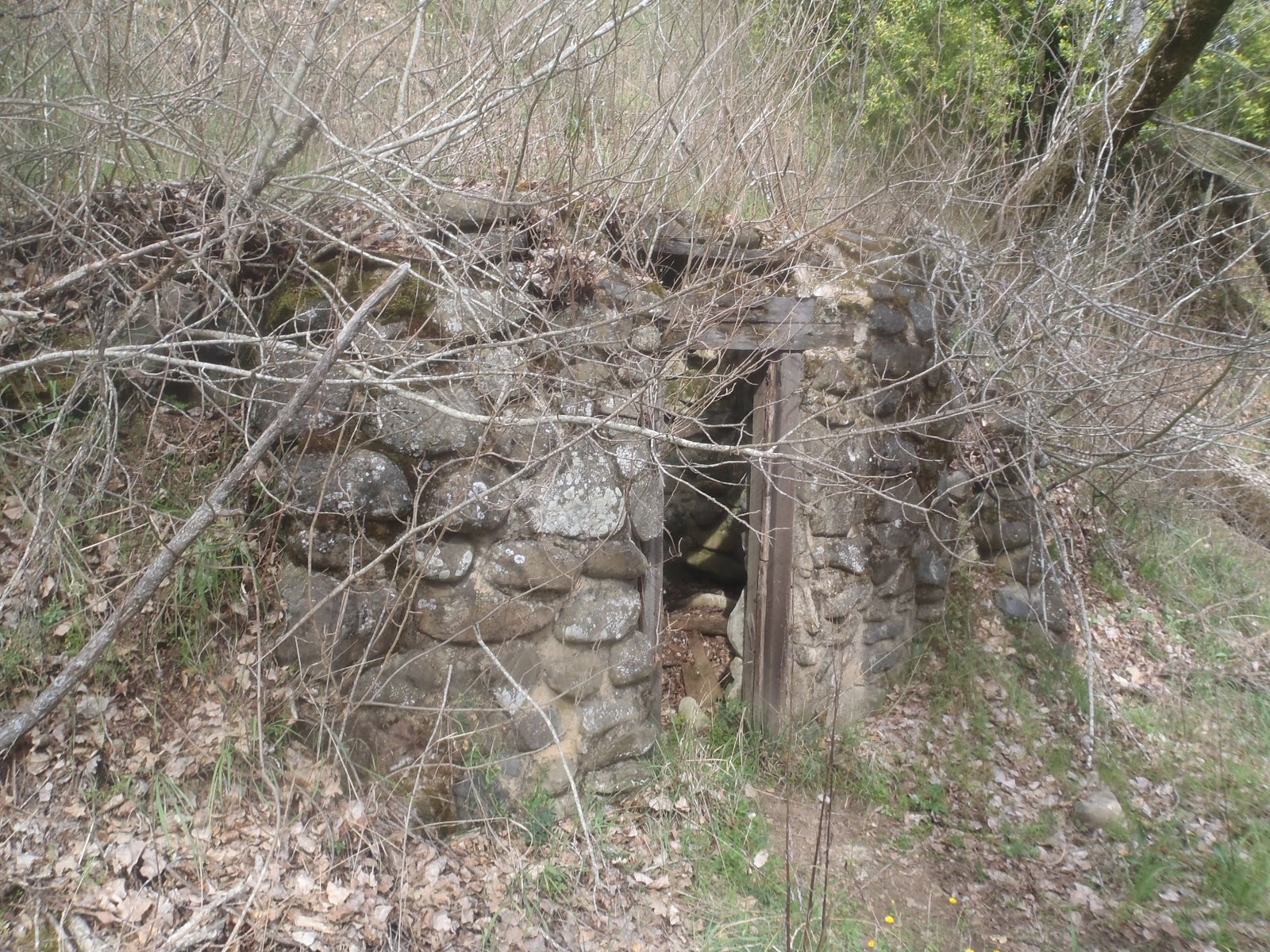
I picked my route through the park towards Orestimba Creek road (my gateway to the wilderness) with as much single-track as I could muster. The park is comprised of several giant ranches that were given to the state back in the 50s. This means most of the roads are old farm-roads that travel the ridges and are meant more for internal combustion engines than travel by foot. The single track was pretty nice, but there were a lot of ticks. Every few minutes I had to stop and flick them off of my legs- not pleasant. On one of the creek trails I cam upon this old stone dugout. It was pretty cool.
Old stone dugout. I wonder from what era?
Cool stream side trails.
Random cabin on private property within the park. Wonder how this happens?
Some of the trail intersections were confusing and I had a tough time resolving my location with the map. I had planned to connect trails to go to the south of Mississippi lake to avoid the bear mountain climb and the extra miles that would add, but ended up taking a wrong turn at on of my intersections. This led me to make some false assumptions at my next trail junction and I ended up going up Bear Mountain road. This road is criss-crossed by coyote creek. Basically this meant wet feet. Oh well, I have heard that that is good training for races too (running with wet feet). By the time I realized I was not going where I wanted to go, I was too invested, and decided to go to the top and follow county line road around to the south end of Mississippi lake.
Views from Bear Mountain.
From Bear Mountain looking into the Orestimba Wilderness, where I would be going the next day.
The sun was starting to set as I reached the lake and I was out of water. I decided to fill up at the lake and discovered that it had a pleasant pond-water taste to it. I guess you want to stick to streams and springs. I then made it to the Hartman trail where I camped the first night on one of the ridges. It was a beautiful camp spot, but the downfall of sleeping on the ridge like this is the wind. I found that if I slept in a certain orientation, the wind was less of an issue. The temps weren't too bad, and it was generally a pleasant night.
Views from my camping spot.
Sunrise the next morning.
Orestimba Creek road going towards Rooster Comb.
Rooster Comb
The next day as I traveled north along Orestimba Creek road, I noticed a hill in the distance with some rock formations on the top. It looked pretty interesting. As I closed in I realized that was the spot where the park sends you off of the road and on to some single track that goes along the hill. I guess the road continues into some private property. Fine by me, it was flat and boring. As I ran along the single track I kept looking up the hill at the formations and thought to myself that I could climb it. And if that really was "Rooster Comb" as the map seemed to indicate, then there would be a Rooster Comb Summit trail waiting for me on the other side that I could just run down and continue up to Robison Creek. Well, the video tells the story:
All kinds of wildflowers.
When I finally reached the Robison Creek trail I found some pretty water falls as the creek empties into Orestimba. It is at this time that I was introduced to the "wilderness". The trail signs no longer meant much. There would be a post with a trail name on it, and an arrow pointing off into the general direction of where a hiker might go if a trail existed. I followed what I thought to be the outlines of an old farm road only to have it disappear before me. I would then check the map, and sure enough, all you had to do was follow the creek-that was the trail. I came to a marker that claimed something called the "Pinto Creek Trail". Studying the map, it led me to believe that if I followed this trail up the mountain, then I could eventually reach mount Stakes, the highest point in the park at around 3500 ft. So I went for it. Every once in a while I could see where a trail might have been at one time, but my best guess is that these are 50 year old unmaintained farm roads that are just going back to the wild. At one point I got so fed up with the bushwhacking that I decided to scale one of the ridges with the hopes that I could find a cleaner line to get to the "mount stakes trail". The issue was that as I reached the ridge I realized that there was still plenty of bushwhacking left to do. I would make some progress, only to come to a dead end, have to retrace my steps and look for another line. The process was slow, it was hot, and the shrubs were scratching me up pretty good. I kept taking breaks under the random trees that dotted the hill to re-evaluate my plan with the map. It seemed like I should hit the mount stakes trail at any moment. As I continued the situation started to get desperate. I was now way too far up, and battled through way too many shrubs to turn around to get back down to the creek. It was hot and I was starting to run low on water. The thing you find out about Henry Coe is that the water is low, and you need to plan accordingly. I just kept thinking to myself, if I find the stakes trail then I can just hammer the downhill and get back to Robison Creek to fill up. Then the thought occurred to me that the stakes trail was just as bad as the pinto creek trail, and then what? It was around this point that I was following a deer trail along the contour of the hill and came within a foot of stepping on a rattle-snake. I heard the distinct rattle sound at the last moment because it was being masked by the rustling of the bushed because of the wind. My heart just about leapt out of my chest. I backed off and was coming to the realization of just how messed up a situation I had gotten myself into. I picked a different line and kept going at the hill. I realized that there was now a higher probability that I was just going to top out rather than hit the stakes trail. I could see the top ahead. I really hoped there would be some old farm roads to lead me down the mountain when I got there. One of the best feeling was when about half a mile from the top I got to the ridge and it just opened up for me, easy cruising all the way to the top. Fortunately I found the roads I was hoping for:
From my climb up to mt Stakes, looking down at Robison Creek where I came from.
The views were incredible from top. You could see all the way through the central valley and the Sierras in the distance. As I followed the road back to the mount stakes trail, I found out that this trail too was being overgrown. It was still runnable for the most part, and since it followed the ridges of this really neat range it was just incredible views the whole way. I would have enjoyed it if I wasn't worried about dying. The scramble up the mountain and the rattle snake, and being almost out of water had left me in a pretty weary state. There was little margin for error at this point, I really had to get back down to Robison. As I tried to follow the stakes trail down I noticed at some point that it got a lot rougher. I was really wondering whether I was going the right way. I ran out of water. At some point I reached another marker that said pinto creek .6 miles. I didn't know what to make of it. Did it mean that that was the Pinto creek trail (which is considerably longer than .6 miles) or just .6 miles until you could get water? Well, the last thing I wanted to do was follow that thing down only to have to climb back up again, and I was pretty sure the stakes trail was going to bring back down to the valley. So I continued on. When I came around the bend I noticed one last steep climb up this pointy hill in the middle of nowhere. That seemed odd to me because the map had indicated that the stakes trail was pretty much a straight shot down the ridgeline. After studying the map some more I came to the realization that this was a random peak in-between the stakes trail and the pinto creek trail, and I was once again, in the middle of nowhere. I couldn't exactly retrace my steps at this point because I could see the valley. It seemed so close. In reality I still had another 1500 ft of descent left. I decided to follow the old overgrown road with the hopes that it would lead me to where I wanted to go. I went up and over the peak and then, dead end. Seriously. The road just stopped and I was surrounded by impassible shrubbery. I decided to try and find a way around and just pick my way down the hillside sorta like what I did to get up the mountain. I came to a gully and knew where that was going, so I just followed it down. That actually worked pretty good. I finally made it back down to the valley and I quickly made my way over to pinto creek where I proceeded to gorge myself on water. This did not make me feel so good, you would think I would learn by now, but it is a totally instinctual reaction to that kind of thirst.
From mt. Stakes looking into the Central Valley and the Sierra's off in the distance.
I washed as well as I could in the creek and then continued back towards Orestimba creek road with the hopes of just getting back home as soon as possible. I had had enough of Coe. My camping spot that night was pretty nice. It was above the Robison Creek falls. The disconcerting thing though was that I would randomly get a tick on me while I was doing my evening chores. I was worried that I was going to have to zip my bivy all the way up to keep the bugs out that night. But as the evening progressed I had less issues and decided to sleep open again. I also experimented for the first time with pulling the back-pad out of my backpack to put down at the foot of my bivy to provide a pad for my lower legs. This seemed to work pretty nice actually. I slept better this night than on many that I can remember while fastpacking.
Camping setup on day 2 near Robison Creek.
Looking down into Los Cruzeros
Day three was just about getting back to the car. I did finally connect up the right trails, the trails that I wanted to take that first day. It was another hot day and I had learned from my previous two days at Coe. I skipped filtering from Mississippi lake on the way back, picked a canyon-spring trail in leu of a ridge-top trail so that I could fill up on water, and generally had a pretty straight forward trek back to the truck. I was wiped though. The heat, and I think, the mental fatigue just accumulated, and I was just ready for it to be over.
I'm going to end this post with one of my favorite sayings by Theodore Roosevelt:
"It is not the critic who counts; not the man who points out how the strong
man stumbles, or where the doer of deeds could have done them better.  The
credit belongs to the man who is actually in the arena, whose face is marred
by dust and sweat and blood; who strives valiantly; who errs, and comes
short again and again, because there is no effort without error and
shortcoming; but who does actually strive to do the deeds; who knows the
great enthusiasms, the great devotions; who spends himself in a worthy
cause; who at the best knows in the end the triumph of high achievement, and
who at the worst, if he fails, at least fails while daring greatly, so that
his place shall never be with those cold and timid souls who know neither
victory nor defeat."
A romantic notion right? I don't know if my wife would agree...
Dude, what an adventure! Congrats on getting Mt Stakes summit on your first try! I thought you were gonna turn around, but I guess there wasn't anybody to stop you! Was there a summit register? Remind me not to take Pinto Creek Trail when we go. Rooster Comb sounds like a fun climb. You definitely have to sign up for Barkley next year. Glad you made it back safe!


My reaction to the last line: *laughs* "What?!*
ReplyDeleteDude, I'm proud of you and what you do. I'm also very glad you're still alive!
Epic post, man.
Alive = good.
DeleteDude, what an adventure! Congrats on getting Mt Stakes summit on your first try! I thought you were gonna turn around, but I guess there wasn't anybody to stop you! Was there a summit register? Remind me not to take Pinto Creek Trail when we go. Rooster Comb sounds like a fun climb. You definitely have to sign up for Barkley next year. Glad you made it back safe!
ReplyDeleteWhat's a register? Perhaps that ridge to the west of pinto would have been better, maybe we could even fine the Mt Stakes trail...
DeleteThat sounds crazy! But cool, too! Those ticks are enough to scare me away though! Great job surviving in the wilderness!
ReplyDeleteTicks were annoying, but surprisingly none even got a bite on me- it must take them a while to actually do something! Thank goodness...
DeleteWhat, no pic of the rattlesnake?!
ReplyDeleteLaughed when you said you slept better that night than usual...no kidding!
The only think I was thinking about with the rattlesnake was: run away, run away!
Delete