I haven't posted in a while. Quick update on what has been going on with my running:
I was taking it easy training wise until Joanne completed her marathon in October last year. She finished it in dramatic fashion, running the 26 mile trail run with 2500 ft of climbing and 5000 ft of descent in 7 hrs and 58 minutes when the race had a cut-off of eight hours. It was a hot day and we knew from her training runs that she was going to be right at cut-off pace all day long, it was just so cool to see her execute and never give in.
After her race I started ramping up my training with the goal of getting myself into good enough shape to compete at the Quad Dipsea race at the end of November. On the way to getting into that shape, I took on a couple of shorter trail races to have a little bit of fun and get some good workouts in. I went out way too hard at the Quicksilver Challenge half marathon in October and faded to 15th place in 1:59. Then I won the Pacifica 17k in 1:29 in November in what was the inaugural PCTR race under the new management of Greg Lanctot and his wife Jenny. Finally, on a rainy, mucky day up in the headlands, I gave everything I had at the Quad and ended up 24th in 5:23. I took it easy over Christmas break and then came back and proceeded to run every Fat Ass 50k I could get to. Oddly I wasn't able to psych myself up enough to sign up for any organized races. I wasn't even interested in defending my 4 mph challenge title. But I have been running a lot and have been feeling good. I was keeping on the table the option of running the Silver State 50 mile (Saturday May 20) and Ohlone 50k (Sunday May 21) double. This is a potent combination that tests the strongest of us, and my buddy Toshi has done it a couple of times, and my other buddy Loren (who has done it before) had talked me into giving it a go this year. When I saw the hot weather forecast I bailed. Now it was almost summer and I hadn't really done anything. No races, no backpacking... it just seemed sad. So I had to get out and do something...
Coe in May:
 |
| I tilted the view of the park. I started from the left and did the teal path day 1, red path day 2, and yellow day 3. |
 |
| This was the first time that I started a backpacking trip at Coe from the Hunting Hollow entrance. I started basically at the bottom of the park where the coyote creek leaves. This was a good call since it was Memorial day weekend and because of Big Sur being cut off from mud slides and one road open to the Sierra, it seemed that everyone descended on this park for the weekend. Starting from Hunting Hollow you can basically write out your own permit and not have to wait in line and there is plenty of parking. And you get to finish your trip with a downhill - which is awesome. This is the valley that you climb out of to get to the rest of the park. |
 |
| Really enjoying the marine layer. |
 |
| Redfern Pond. You can see a tent off to the right. A few guys had set up basecamp here to do fishing and day hikes. The guy had talked to me about wanting to lighten up his backpacking load, but it looked like he was living it up with his GoPro, fishing setup, camp chair, and all of the extras. |
 |
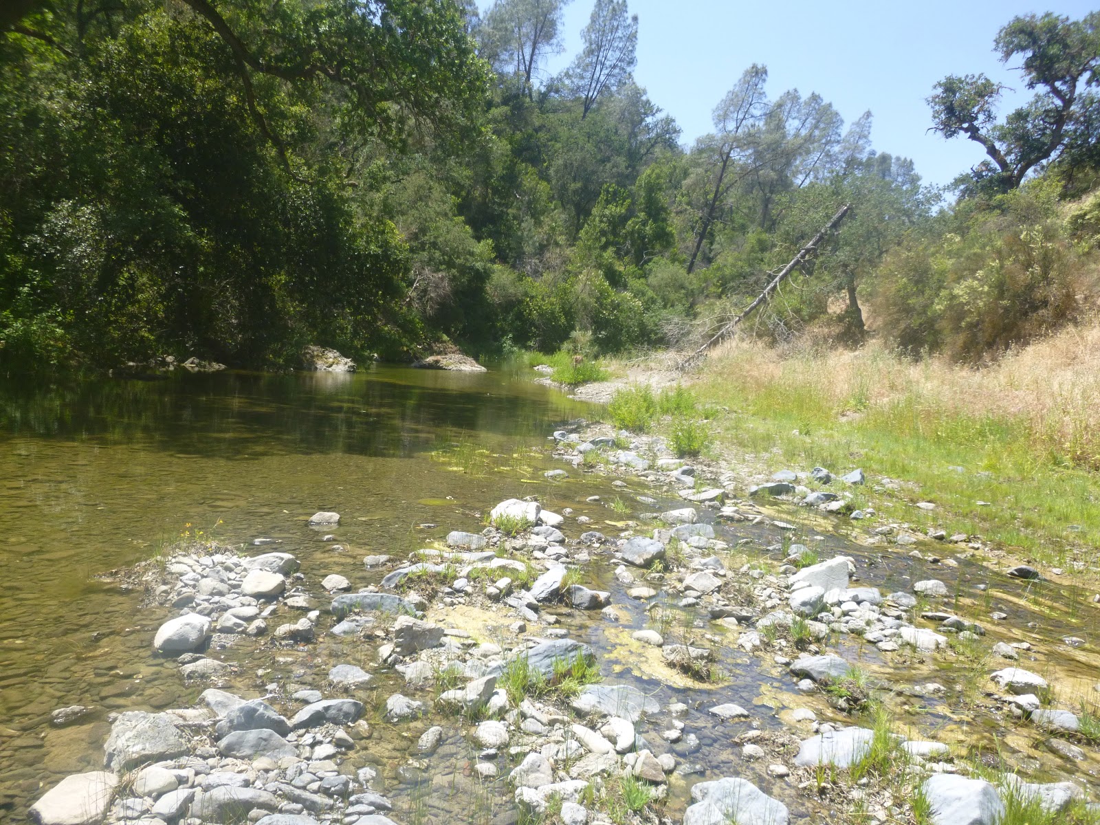
| Hunter's Gulch was still flowing well in May. |
 |
| Vasquez road on the way to Burra Burra Peak. This is the one section of the park that I haven't really explored yet. There were some overgrown sections that made me a little nervous, as in the kind of nervous that you get when you think there might be a rattlesnake under that grass that you are stepping on. |
 |
| Dormida creek was flowing nicely. I think this is a reliable water source. It was also down in this creek where I had my tick attack. I got ticks on my twice on this trip. One tick up at Robison creek. and about six that I had to flick off down here at Dormida. I was looking for the Dormida trail that would give me a more direct route up to Burra Burra, but it wasn't obvious to me where it was, and I was really nervous about all the ticks that were on the attack and relished getting onto an open fire road. I ended up following Vasquez road up to Center Flats for the long way around to Burra Burra. |
 |
| Burra Burra. |
 |
| Rocks on the west peak of Burra Burra. |
 |
| Views from Burra Burra east towards Pacheco. |
 |
| Just below Burra Burra is the Dowdy Headquarters. This is the east entrance to the park from Kaiser Aetna Rd off of 152. There were a couple of elderly lady rangers in charge here that looked to be completely overwhelmed. They explained to me that they are used to maybe having three visitors on the weekend. Their parking lot was full. There wasn't anything to see here. I was hoping for some kind of historical artifacts, but they had once glass case with four boring implements. California history sucks. |
 |
| Beautiful descent down Macks Corral. Freshly weed-whacked. |
 |
| North fork of the Pacheco Creek. One of the nicer creeks in the park. |
 |
| One of the tributaries to the Pacheco Creek on the climb up Dutch's trail to get to Mustang peak. This was my last fillup for the long haul through the hottest part of the day. I would be completely empty by the time I got down to the Orestimba. A complete fillup for these purposes is about 110 oz. |
 |
| Incredible views of the park from County line road nearing in on Mustang Pk. In front you can see the Robison Ridge and behind you can see the Stakes Ridge. |
 |
| The Orestimba wasn't exactly raging. At least by this point down river it wasn't too warm. And it tasted ok. Up river from here I wasn't interested. I filled up, cooked dinner (mountain house chili mac, it was average) and then had to decide what my plans were with the Orestimba wilderness. At this point I decided with the sun and heat that I was facing that I just wasn't interested in another Mt Stakes expedition, so I settled with a circumnavigation of the Red creek - Robison Creek drainages. |
 |
| Red Creek Road looking back towards the Orestimba. This is known as Paradise Flats. There used to be an airstrip off to the right. |
 |
| The parks in this neck of the woods have a terrible problem with feral hogs. Here, three of them are enjoying life under an oak. |
 |
| Whats left of Paradise Lake. They had a massive dam collapse |
 |
| It must have been quite the sight to see this dam give in. |
 |
| Sunday morning wakeup along Red Creek. |
 |
| Before climbing up the ridge to drop into the Robison drainage I met the first person without the name of Toshi or Sachin that I have seen in the Orestimba wilderness. He was going the same route that I was, and I gave him some beta. I would see him again later. |
 |
| Robison was flowing nice in the upper part of the valley, but was hardly noticeable in the middle where the valley widened out. Then it was flowing good again at the falls before it joins the Orestimba. |
 |
| The confluence of Robison and Orestimba. Here I met underwear Dave. He is the second person without the name of Sachin or Toshi that I have seen in the wilderness. And he was hanging out in his underwear. Interesting guy. Some kind of amateur archaeologist with an interest in the areas native Americans. He was exploring old sites. Later he would show me some pits in the ground in a valley that would be the foundation of a wigwam or whatever they called their houses. There was a whole village there. |
 |
| Views of the Orestimba Valley from the Rooster Comb trail. |
 |
| Kitty. |
 |
| After I was done with my circumnavigation I decided to make progress back to Hunting Hollow. It was so hot and exposed on the Orestimba road that I was just getting cooked and decided that I didn't want to get cooked again on Monday, so I started devising my exit strategy so that I would be done by lunchtime the next day. This necessitated a little bit of a night hike, which was much more preferable than day travel at that point. |
 |
| View of Burra Burra from Wagon road as the sunlight fades. |
 |
| Monday morning on a ridge outside of Wilson Camp. I toyed with the idea of getting all the way to Wilson camp, which would have left me with a short 4 mile hike back to my car for Monday, but then thought about all the people at the park and realized it was probably a busy affair and all of the critters would be aware too. I don't even bother trying to hide my food from the animals on these trips because I usually set up in pretty obscure places. The problem people have with critters getting into their food is when the animals set up shop next to an established camp ground where they have gotten used to it. Anyways, I climbed a little ridge from the trail and found a nice spot in a field under some oaks which was perfect. I didn't bother with the rain fly because I figured there was no chance of condensation all the way up here. To my surprise I woke up to a foggy morning! |
 |
| The fog burnt off a little high on the ridge and I got some sweet views of the inversion. |
 |
| Views of Wilson camp. It was as I suspected. There were a ton of tents. And strangely enough, as I passed by at 7:30 a.m. there was not a peep to be heard. I could hardly believe that a whole camp of people could sleep in like that! For a moment I thought about running through their camp and giving them the wake-up call. |
 |
| Getting back below the clouds back to Hunting Hollow. |
I enjoyed my trip, but I think May might be too late for Henry Coe given my preferences. The long hot days just kicked my butt, and the walks through the fields could leave me poked pretty good. So many prickly things... Something else I need to remind myself for future trips: Backpackers pantry Pad Thai might be the best foil bag meal I have ever had.