Back to back in the high sierra (thanks Joanne!). It has been a great past two weekends where I got to explore all kinds of new incredible territory. This past weekend Sachin and I backpacked 54 miles with over 11000 ft of climbing taking two days. Sachin proposed a big loop starting at Lodgepole campground in southern Kings Canyon. I had never been there before and was excited to check out some new terrain.
Sachin's loop. 54 miles with over 11000 ft of climbing. Red is day 1 (33 miles, 6824 ft climbing), Blue is day 2 (21.4 miles, 4508 ft of climbing). Start/Stop is Lodgepole campground in Kings Canyon.
We started the hike in the dark, climbing through the forrest. As we came around one of the corners we spotted a couple set of eyes shining back at us. A couple of bear cubs were traveling the trail ahead of us. We assumed the mother was with them, but never got a good look. We kept making noise, attempting to get them out of the way, but it probably took 10 to 15 minutes of us chasing the bears up the hill before they decided to crash downhill through the forrest.
We were in wilderness territory, outside of the bounds of Kings Canyon National Park, and came across a hunter who was questioning us about the trail that we had just descended. Here we see a "snow surveyors shelter". I guess when things get crazy in the winter, the surveyor can seek some safety here.
Much of the first half of the loop was through the forrest without extensive views of alpine granite terrain. We did get pretty high and were able to see some fun stuff in the distance.
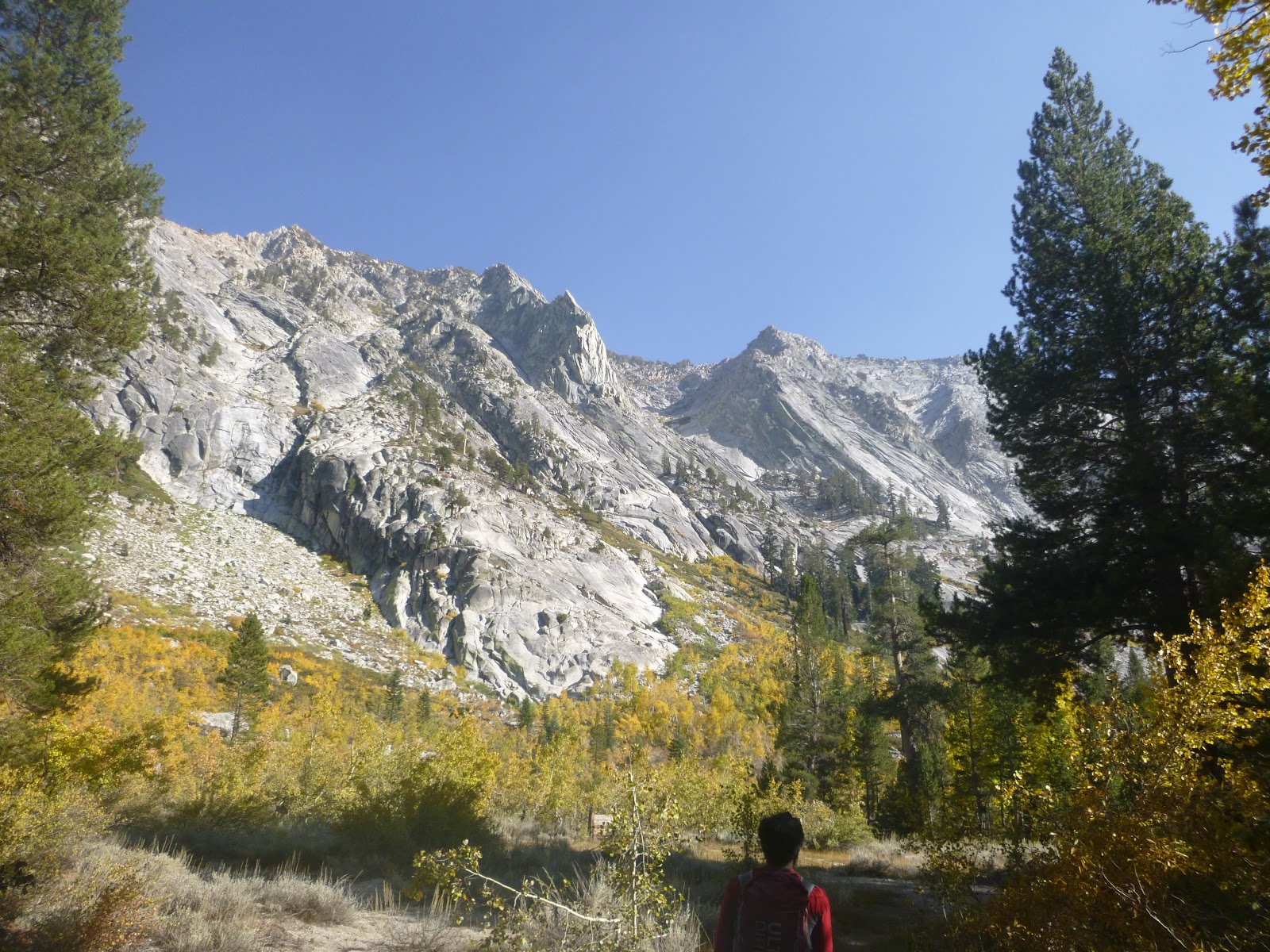
Our trail skirted Sugarloaf peak. It was a very prominant chunk of rock.
We saw plenty of this.
As we start to climb up Deadman's Canyon, we start to see some serious rock.
Sachin was loving the Aspen.
Following trail climbing up this creek reminded me a lot of a canyon climb on the IMTUF course in Idaho.
Notice the smooth U carved out by glaciers a long time ago.
The Canyon just kept going and going and getting better as we went.
Here is a Video of of the stream falling down the rocks:
As the sun started to set we were scouting out a nice place to camp that set us up to tackle the pass in the morning.
We reckoned this would be the perfect spot. Some nice soft, flat sand, protected by rocks with the soft sound of the waterfall in the distance.
It got pretty cold, but it was actually a comfortable night of sleep, all things considered.
Now starting to climb from the floor of the valley in the morning.
Up and over the top of Elizabeth Pass.
Video of one of our breaks on the High Sierra Trail:
Some really weird looking rock in the distance.
This section of the High Sierra Trail contoured a very steep mountain side with some spectacular views off to the left.
Great trip! After we cleaned up a little we actually went right next door to inspect the General Sherman, a giant Sequoia. It has the distinction of being the largest tree in the world. Which means I have now seen the big three: Grizzly giant in Yosemite, General Grant in KC NP and Sherman in Sequoia NP.
This backpacking route was the brainchild of my buddy James Bueno. He was gracious enough to drag me around the mountains for three days on high sierra trails and cross country in Kings Canyon National Park.
Our Trip. Starting at Roads End in Kings Canyon NP going clockwise: Red is day 1, Green is day 2, and Blue is day 3.
Stats for the trip:
Day 1: Roads End to other side of White Pass: 25.1 miles and 9869 ft of climbing
Day 2: White Pass to north side of Pinchot Pass: 17.7 miles and 5157 ft of climbing
Day 3: Pinchot back to Roads End: 27.2 miles and 2093 ft of climbing
Totals: 70 miles with 17119 ft of climbing
Day 1: Roads End to other side of White Pass
We started up the Copper Creek climb which was about 5000 ft in 8.5 miles. It was a nice warmup given our chilly 6 a.m. start. Saurabh Basin joined us for the first 16 miles of our journey. Saurabh is a dedicated ironman triathalete who also runs ultras. It was cool to get to know him a little better, I am sure we will share some runs in the future. Here you see the silly looking big guy, James and his pointy pole, and Saurabh showing us how a hydration system works.
It was almost like entering a different world as you climbed up out of the valley.
Near the top of the Copper Creek climb we veered off the trail to take a treck through the high country. This particular stretch of trail is described as part of the Sierra High Route. The route is not necessarily a trail, but describes a line you might take through the mountains that keeps you at high altitude. The best way I can think of to describe it is to compare it to the John Muir Trail (JMT). The JMT was designed to allow for an efficient, stock passable, route from Yosemite Valley to Mount Whitney. This means that a trail can be built that allows the quadrupeds to not freak out in the mountains. The Sierra High Route, on the other hand, parallels the path that the JMT takes, but tries to keep you high and assumes that you have four limbs and know how to use them to climb stuff. The high route is not for quadrupeds. And it is not a trail, necessarily. Here we see James telling us that we don't need to filter that water. I filter anyways.
Grouse Lake. This is the first lake we encounter along the high route.
Looking down at the lake from Grouse Pass. We climbed up from the bottom of the valley that is beyond.
James is happy to be here.
Saurabh is enjoying a cross-country hike. Maybe.
The other side of Grouse Pass we see our first snow field that we need to cross.
After crossing the snow field we strategize the descent down to the glacier lakes.
Video of the Glacier lake pass descent:
One of the glacier lakes.
Cool dead tree.
Saurabh, negotiating the rocks on the downhill.
Really interesting rock features.
Saurabh showing us how it is done!
The glacier valley descent to Dougherty Meadows. After completing this section of the high route, Saurabh followed the trail back to his car as he had to be back in town to go to work on Monday. James and I continued on the adventure. We followed a short section of trail to visit the State Lakes, but then veered off of the trail once again to explore the high country.
Video of the Windy Ridge Crossing:
As we trekked cross-country we came across this cool flat spot that would make a pretty spectacular camp ground with the views in the distance.
One of the horseshoe lakes I think.
Views from Windy Ridge as we traversed over to the south fork of Cartridge Creek.
Joanne liked this picture. It made her feel warm and cozy inside.
One of the views we had as we were climbing the "White Pass". This climb was pretty brutal on us. We kept coming to a wall of rocks that we assumed was the final stretch and we would be done with the climb, only to find another wall of rocks waiting for us. The sun was going down and we were behind schedule on reaching Marion lake for the first night. James was getting headaches around 11000 ft and it was going to be cold that night, so we wanted to drop at least some elevation for a decent night of sleep.
That decent night of sleep didn't happen. We dropped down off of White Pass in the waning light to some wet valley where we were forced to make camp. We desperately picked a flat piece of earth maybe 50 ft from a high alpine bog. As we set up and cooked dinner, a mist settled on our gear that pretty soon turned to frost. Needless to say, it was a fitful night of sleep. On the plus side, while I was waiting for my meal to hydrate, I took the desert hill climb record from Seth. I think James might have been slightly annoyed that as we were the only people in this little corner of the earth - a peaceful, starry, night, getting ready to eat our last meal for the day and hit the sack - I am there on my smartphone, playing a silly computer game attempting to regain my honor as the family "hill climb" champion. Seth (my six year old) had been earning minutes on my phone by doing chores and had collected basically all of my records in the last few months. Well, that night I took back the "desert stage" in commanding fashion. And I let the whole world know about it. But I think James was the only person to hear my celebration.
Day 2: White Pass to north side of Pinchot Pass
The view looking back at the "wet valley" as we climbed the Red pass the next morning. One of the scarier moments of the trip for me was as I was packing up my stuff from camp, I threw out my lower back. I seem to do this to myself once or twice a year, and it usually happens when doing some sort of mundane thing like bending over to tie my shoe laces. What really freaked me out this time was the realization that we were really in the middle of nowhere, and if my back decided to really complain, there was going to be no way to put the weight on my back and make the climbing moves required to get over the mountain passes. Fortunately the injury seemed to be of the minor variety and I started to be very careful with my movements. Also fortunately, it seemed that the constant and varied movement that we were doing seemed to keep the pain at bay. I know when this injury happens in the real world - sitting at a desk is one of the more painful ways to work through it. Who would have thought that a better option would be to do something really difficult?
Views from Red pass.
Looking down on lale Marion from Red pass.
We descended this.
Blue.
Really blue. I don't know what is going on with this lake, but it is weirdly blue.
The gulch descent down to lake Marion.
I told you it was blue. Right?
Views as we climbed up to Dumbbell Pass.
The other side of Dumbbell Pass we were treated to a fun snow field descent. It was really exhilarating for me because it was such a novelty. I was being super careful, jamming my hiking poles into the snow and taking little steps as I was afraid of loosing traction and sliding down the hill into some rocks and having a bad ending to my trip. Fortunately, we saw some tracks in the snow which meant someone else had braved it first. That gave us enough confidence to go ahead and go for it.
It gets pretty cold at night...
Sweet snow feature down by the lake.
James - looking back at the Dumbbell lakes basin from which we hiked up to the Observation Peak pass.
Here was our first view of the other side of Observation pass. I saw this snow field and walked up to the edge to find out it was a cliff.
As close to the edge as I dared step. I believe they call this a "snow cornice". Basically a cliff of snow.
I didn't know where we could go. I began to think this was the end of our journey and we would have to backtrack somehow. That thought scared me too! Could we actually climb all of that stuff that we went down? The whole thing seemed pretty overwhelming at that point. James was more positive. He was smart and actually saved some trail beta on his phone that we were using to navigate with. Trail beta is basically information on trail travel that someone else has made available. James had researched this route before we set out and was pretty confident that we could do it. The beta had said that finding the cornice was a possibility and suggested that we could climb up to the left and find a bypass down the mountain to get past the snow. It worked! Here is a view of the cornice from our "bypass"
Looking back up at the snow cliff after we climbed down the bypass.
The snow field descent off of Observation Pass. I was trying to be careful, but then slipped and fell on my butt. I kept sliding but found I could control my slide as long as I didn't build up too much speed. You can kind of see my butt slide path to the left of the rocks in the middle of the picture.
Video of James showing us his Ski technique:
Amphitheater Lake. We came down off of Observation pass and then had to do some Talus hopping along the shore until we got to this point.
That is the pass that we just descended from. The snow cornice is the little speck of white at the bottom of the "V". You can see the snow "O" around the rocks that James and I slid down. Then we did a little bushwhack through the little bit of green stuff you see, and then did some Talus hopping down to the shore. I would say that this descent was one of the highlights and big challenges of the trip!
Video of Amphitheater Lake:
Do you see the smooth "U" in the middle of the picture? That is the last cross-country pass of the trip - the Upper Basin Crossing!
Views down to Amphitheater lake as we climb to the pass.
Views I was soaking in as we assessed our situation. We were only 150 ft from the top of the pass and then hit an obstacle. I couldn't figure out a safe route to get to the top. From my vantage point I saw smooth 45 degree angle rock going straight up to the pass. That scared me because I assume that if you lose traction on that rock that you will go sliding down and smash into the Talus that we had just climbed. James caught up to me and said he would scout across to the north and see if there was a better way. He found a gully that had some potential. I traversed over to where he was pointing and decided to go for it. It was still really sketchy, but it was probably the best of the bad choices. I suppose we could have backtracked - but we were too far, too deep in, to give up now. And the thought of trying to go back the way we came seemed just as scary as taking the risk up the gully. As I scrambled up the pass I was coming across a bunch of lose rocks that I was scared of sending towards James. I gave him warning and he said he was paying attention. I don't know how much good that would have done. One of the lose rocks shifted and cut my shin, but I was committed to the move at that point and got up over the ledge. With adrenaline pumping I made it to the top of the pass and then got out my camera to try and get some footage of James reaching the top as well.
Video of James making it to the top:
After enjoying a really mellow hike descending the upper basin and then crossing the south fork of the Kings River, we joined up with an actual trail! Here we started cruising along the JMT making progress back to the car. A wave of relief washed over me as I realized that the difficult stuff was done and my back had made it through.
We camped near here on night two.
At this camp we saw the first other hikers on this trip. We had the whole high country to ourselves, but the JMT is a little more popular. There was a nice couple here that was telling us about their month long adventure on the JMT. It was pretty interesting as the guy had his own company in Santa Cruz and would enjoy a beer and complete payroll on a mountain pass. They were traveling slow and in style. The lady was capturing 360 degree video. It looked like they were enjoying themselves. Unfortunately their solar charger had crapped out on them and they were currently at the mercy of other hikers sharing their power. James was gracious enough to let them charge up their gadgets off of his battery that night.
Day 3: Pinchot back to Roads End
Early morning cruising.
Still climbing.
Video as we were climbing to Pinchot Pass:
Making it to the top of Pinchot Pass the next morning.
Spot James.
See him now?
How about now?
Making progress
Almost there.
Made it!
Descending Pinchot into a wide, barren landscape.
Quick 360 video as we descend the JMT:
Joining up with the Woods trail descent to get back to the car.
Video of Woods creek falls:
It looks like this bridge got taken out at some point. It was a pretty sturdy bridge too! Maybe a big tree with high water? Anyways, there was a sign warning people not to cross - which was laughable to James and me. Who would hike all the way to this point and look at that river and decide to turn around? Common.